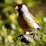
A complete, annotated, and illustrated
checklist of the birds of Monterey County, California:
| THE MONTEREY
COUNTY LIST
Annotated
checklist and data resource
|
|
text © Don Roberson
photos copyrighted by photographer(s) credited
all photos taken in Monterey County, California
|
This is the portal to pages of an annotated, illustrated,
and complete checklist of the birds of Monterey County. The annotations
are the bold-faced status and distribution summaries from the species accounts
in Monterey Birds, 2d ed. (2003) by Don Roberson, slightly modified
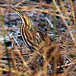
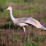
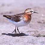
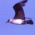
for the web. All the birds shown were photographed in Monterey County.
About 270 of these are from my own collection, but major contributions
were made by local photographers Ronald L. Branson, Bill Hill, John Sorensen,
and Robert F. Tintle, all of whom have 15 or more photos shown. In addition,
the Big Sur Ornithology Lab contributed photos of banded birds when needed,
and more than 30 other photographers contributed 1-3 photos each to fill
out the missing species. More photos are still needed (see bottom of page).
In choosing photos, birds photographed in the wild in Monterey County
were preferred, even if better in-hand photos were available. If no such
photos were located, birds photographed while being banded in MTY were
used. Lacking these, photos of MTY specimens are shown when possible and
lastly, portions of sketches or written details of MTY records are included
when available. Some 24 species on the MTY checklist are documented by
details of such sight records only.
Individual species pages — linked to the checklist
annotations — will be added over time.
Some are available now [e.g., see Thayer's Gull] and it is anticipated
that eventually all species will have a species page discussing local status,
distribution, and identification in much more detail.
This project will take some time (years); for now, the Checklist and
species pages now linked, can be a resource for all.
|
The checklist has eleven segments, as follows:
ABBREVIATIONS: Some abbreviations used on the checklist pages include:
-
MTY = Monterey County
-
Hastings NHR = Hastings Natural History Reservation, a research
facility of Univ. of Calif. Berkeley
-
Mt. = Mountain; likewise Mts = Mountains and Pk = Peak
-
NM = National Monument; likewise NWR = National Wildlife
Refuge
-
nmi = nautical miles
-
R. = River
-
SB = State Beach; likewise SP = State Park
-
wtp = wastewater treatment plant
Acronyms for museums credited in this project are:
-
CAS = California Academy of Sciences, San Francisco
-
LACM = Los Angeles County Museum, Los Angeles
-
MLML = Moss Landing Marine Lab, Moss Landing
-
MVZ = Museum of Vertebrate Zoology, U.C. Berkeley
-
PGMNH = Pacific Grove Museum of Natural History
MORE PHOTOS WELCOME: If you have nice photographs taken in Monterey
County of any species not illustrated by a photo of a wild bird on
these pages, I'd be happy to add your shot to this project. Also, if you
have an excellent photo that would significant upgrade the current illustration,
I'd like to consider using it. Please contact me at creagrus@montereybay.com.
CREDITS & ACKNOWLEDGMENTS: This project could not have been
undertaken without the help of numerous photographers in Monterey County.
I especially thank Ronald L. Branson, Bill Hill, John Sorensen, and Robert
F. Tintle for their exceptional local photographs; Bob Tintle permitted
me to search his entire collection (and he has 57 photos herein) and the
others graciously responded to specific requests. The Big Sur Ornithology
Lab was also very cooperative, and I'd especially like to thank Sarah Stock,
Jim Booker, Jeff Davis, and Craig Hohenberger for provided photos to me
over the years. Other photographers with multiple shots in this collection
are Jim & Helen Banks, Ed Harper, Peter LaTourrette, Brian J. Weed,
and Stan Wulkowicz. Contributors of at least one photo to this project
are Larry Balch, Nancy Black, L.J.V. Compagno & D.H. Varoujean, Betty
Cost, Lis Covello, Michael Danzenbaker, Ivan Eberle, Al Ghiorso, Greg Hoffmann,
Ed Kwater, Paul E. Lehman, David Lemon, Scott MacDonald, Paul Matray, Tristan
McKee, Rod Norden, Robert L. Pitman, Jeff Poklen, Bernadette Ramer, J.
Van Remsen, Anne Spence, Craig Strong, Ian Tait, Richard Ternullo, Jerry
Wettle, and Steve Wilson.
I also thank Rita Carratello, Bill Hill, Jeff Poklen, Dan Singer, and
Jim Tietz for comments on earlier versions of these pages that have improved
their content
DETAILS, DETAILS: See Monterey Birds, 2d ed. (2002)
for use of the terms in this project. The birds' behaviors define terms
differently. Thus many shorebirds are "fall migrants" in July-August while
many landbirds are not "fall migrants" until September or later, and July-August
status would be considered "summer" for these landbirds. Our early breeding
Allen's Hummingbirds can arrive in January, but only first nesting Black
Swift may not arrive until late May or June. Thus the breeding season for
these species is very different. Keep this distinction in mind when using
the capsule status summaries.
The term "photographed in Monterey County" has a little bit of wiggle
room. Obviously, for birding purposes, we consider any birds within
200 nautical miles of the MTY shoreline as within Monterey County, if the
MTY shore is the nearest point of land. Technically, of course, the statutory
boundaries set out in the California Government Code do not extend that
far; this "200 mile offshore" rule has been widely adopted for birding
purposes throughout the world.
In addition, I've included photographs in this project that were taken
on the Santa Cruz County side of the Pajaro River if, and only
if, the specific bird photographed was also recorded on the MTY side
of the river at some point. Right now this applies to Black-backed Wagtail
only, but could apply to other birds in the future. Finally, common birds
photographed in the western portion of Pinnacles National Monument are
used in this project, if the photographer reached the National Monument
through the west access road. Here the boundary between Monterey and San
Benito counties wanders in and out of the National Monument. All the birds
are equally common on both sides of the boundary, and if the photo is from
the west slope of Pinnacles National Monument, that's good enough for this
project.
Readers may use this material for their own private enjoyment,
study, or research but none of the photos or text herein may be used commercially
nor may they be reposted on other web sites without written permission.
All material is copyrighted. The posting of photos and text on this private
web site is not a submission to review organizations.
TOP
TO HOME PAGE
TO MONTEREY COUNTY
PAGE
TO BIRD FAMILIES
OF THE WORLD
Page created 1-5 Mar 2004


