 |
||
|
Hammond's Flycatcher
20 June 2006 at Butte Meadows Campground |
||
 Butte
County is a mid-sized county containing a large chunk of the mountainous
terrain where the north end of the Sierra Nevada merges into a complex
of ranges that become the Cascades. It was one of the original 27 counties
of 1850 but was then much larger. Subsequently, Plumas County and much
of Lassen County were carved out of its eastern half. The west end of the
county is anchored at Chico in the Sacramento Valley; Bidwell Park is a
well-known urban park there. The Feather River runs through the middle
of the county, and the large reservoir of Lake Oroville sprawls over much
of its current southeastern portion. Thermalito Forebay and Afterbay are
important birding spots. In the southwest, Gray Lodge WMA, along with Upper
Butte Basin WMA and the Llano Seco Unit of Sacramento River NWR, host thousands
of waterfowl in winter. Butte
County is a mid-sized county containing a large chunk of the mountainous
terrain where the north end of the Sierra Nevada merges into a complex
of ranges that become the Cascades. It was one of the original 27 counties
of 1850 but was then much larger. Subsequently, Plumas County and much
of Lassen County were carved out of its eastern half. The west end of the
county is anchored at Chico in the Sacramento Valley; Bidwell Park is a
well-known urban park there. The Feather River runs through the middle
of the county, and the large reservoir of Lake Oroville sprawls over much
of its current southeastern portion. Thermalito Forebay and Afterbay are
important birding spots. In the southwest, Gray Lodge WMA, along with Upper
Butte Basin WMA and the Llano Seco Unit of Sacramento River NWR, host thousands
of waterfowl in winter.
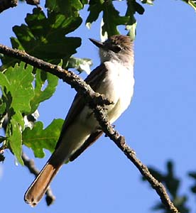
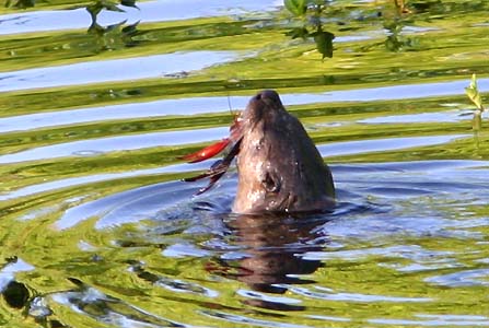
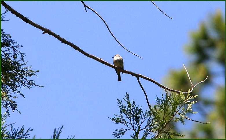
County birding statistics and links are on Joe Morlan's site. For Butte County, I chose this shot of a Hammond's Flycatcher on breeding territory. As is typical of this species, it is perched rather high in the canopy, but you can still see the very short bill, very short tail, and long primary projection. My other two shots are from an oxbow of the Sacramento River in Bidwell-Sacramento NWR, right on the western edge of the county. The native oak woodlands here have Ash-throated Flycatcher (below left; note the useful tail pattern). These oak woodlands abut the oxbow lake, and during our early morning visit, a family of River Otters were dining on crawfish. I like this shot (below right) of one otter and the colorful breakfast, set against the golden reflections on the still pond. Yes, it is not a bird. Sometimes I cheat.
|
||
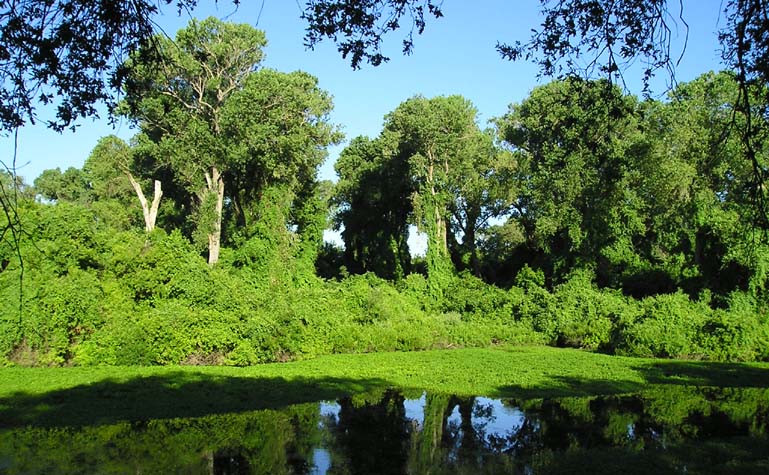
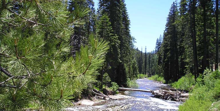
Here is that oxbow lake at Bidwell-Sacramento NWR (upper shot, below).
One can undertake a fine transect of California life zones in Butte, from
the Sacramento River into the high Sierra. The bottom photo shows a rushing
stream well up Humboldt Road, near the end of the pavement at Jonesville
(both photos 20 June 2006).
 |
||
 |
||
| All photos & text © 2006 Don Roberson; all rights reserved. | ||
|
TO NEXT COUNTY |